Iceland volcano: Aviation risk level from Bardarbunga lowered
- Published
Omar Valdimarsson, speaking to the BBC from Reykjavik, said there was a "50-50 chance" of a full eruption
Iceland has lowered the warning level to aviation from the Bardarbunga volcano from "red" to "orange", its second-highest level.
However, the Icelandic Met Office, external said there were "no indications that [seismic] activity is slowing down" and added "an eruption cannot be excluded".
Earlier, two earthquakes shook the area around Bardarbunga.
Iceland's Eyjafjallajokull volcano erupted in 2010, producing ash that disrupted air travel across Europe.
Seismic activity began in the area on Tuesday. Iceland's Met Office said it recorded earthquakes of magnitude 5.3 and 5 in the early hours of Sunday morning.
They were the strongest earthquakes to hit Bardardunga since 1996.
Airspace over the site has been closed, but all Icelandic airports currently remain open, authorities say.
Authorities said on Saturday that a small eruption had taken place under the Dyngjujokull glacier but that there no signs that gases or ashes had broken through the ice.
Geologists reported that about 300 earthquakes had been detected in the area since midnight on Tuesday.

On Wednesday several hundred people were evacuated from the volcano area
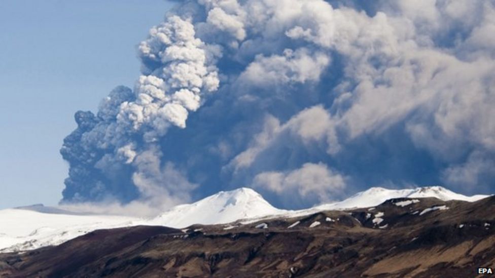
The eruption of Eyjafjallajokull in April 2010 caused the largest closure of European airspace since World War Two
The Eyjafjallajokull eruption in April 2010 caused the largest closure of European airspace since World War Two, with losses estimated at between 1.5bn and 2.5bn euros (£1.3-2.2bn).
Criticism following the strictly enforced shutdown resulted in the UK Civil Aviation Authority relaxing its rules to allow planes to fly in areas with a low density of volcanic ash.
Bardarbunga and Dyngjujokull are part of a large volcano system hidden beneath the 500m-thick (1,600ft) Vatnajokull ice cap in central Iceland.
The region, located more than 300km (190 miles) from the capital Reykjavik, has no permanent residents but sits within a national park popular with tourists.
Authorities have previously warned that any eruption could result in flooding north of the glacier.
- Published10 April 2013

