Antarctic photo science archive unlocked
- Published
Aerial photos from the 1940s and 1950s are being used to probe the climate history of the Antarctic Peninsula.
UK scientists are comparing the images with newly acquired data sets to assess the changes that have occurred in some of the region's 400-plus glaciers.
The old and modern information has to be very carefully aligned if it is to show up any differences reliably.
And that is a big challenge when snow and ice obscure ground features that might otherwise act as visual anchors.
But the researchers from the British Antarctic Survey (BAS), Newcastle University and University of Gloucestershire believe they are cracking the problem.
"We want to use these pictures to work out volume and mass-balance changes in the glaciers through time," explained Dr Lucy Clarke from the University of Gloucestershire.
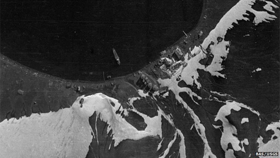
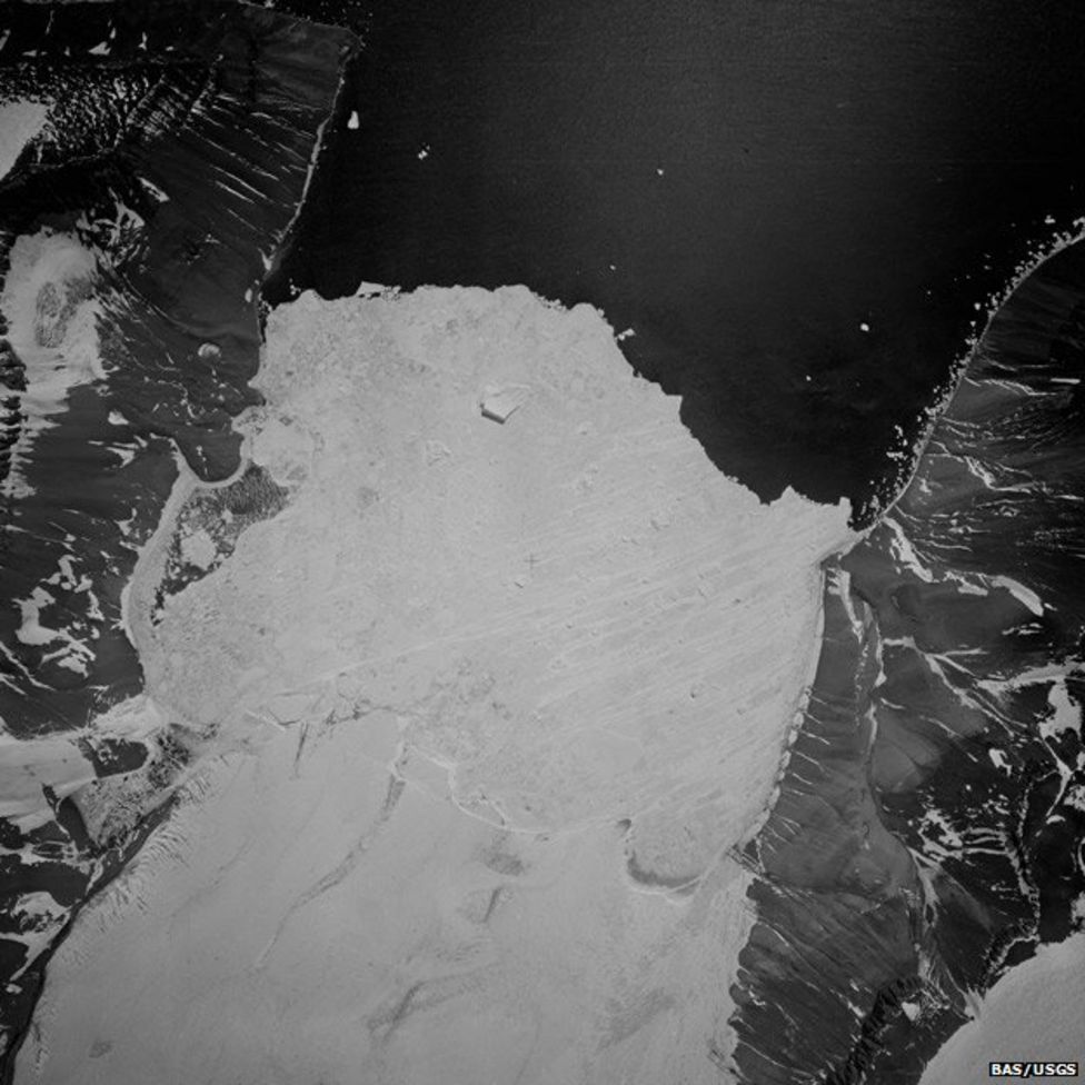
"There are tens of thousands of these historical images, held by the British Antarctic Survey and the US Geological Survey.
"So, they've long been around, but it's only now that we've had the capability to extract the 3D data from them."
Dr Clarke has been presenting the work at this week's American Geophysical Union Fall Meeting in San Francisco.

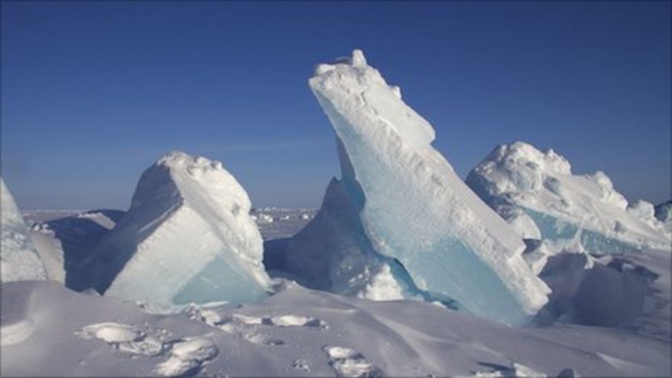
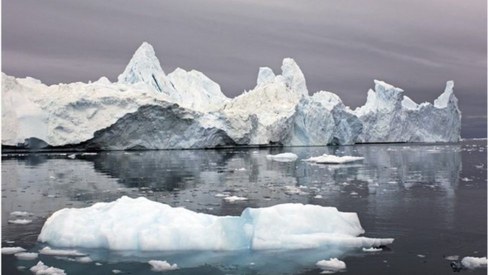
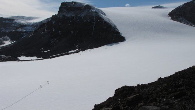
The Antarctic Peninsula - the northernmost extent of the White Continent which stretches up towards South America - has experienced quite dramatic warming in recent decades.
The fronts of many of its glaciers have quite obviously retreated, and several of the marine-terminating ice streams have even seen their floating shelves disintegrate.
But getting at the volume and mass changes in the glaciers has been a thorny issue.
Satellites are used to track such trends today but their record spans only a few decades.
Drs Miller and Clarke: "The pictures were collected on British expeditions"
The archive of aerial photos, on the other hand, goes back to the 1940s, and it represents an extraordinary account of the pioneering days of polar exploration.
The men who ventured forth in their planes to capture pictures of the peninsula's rugged ice-scape took huge risks, with none of the back-up that modern expeditions can count on.
"They had no idea what they were flying into because no-one had ever been there before," said Dr Clarke.
"And all the photographs, they would develop using nearby glacial stream water at the base camp they set up," she told BBC News.
Dr Pauline Miller from Newcastle University added: "The 1940s were just about flying to see what they could find, but by the 1950s it was much more systematic - for topographic mapping purposes. It was all about staking a claim in Antarctica when nations were becoming more competitive."
That these old images still have scientific value in the 21st Century is down to novel techniques that are able to precisely position the pictures using newly created accurate, modern-day elevation models of the peninsula.
The team is using the latest optical satellite data to do this, as well as modern aerial photos acquired by BAS planes equipped with GPS.
Fundamental to these techniques is finding visual cues in the ice-scape that allow historical and current information to be married up.
"These visual cues have got to have some kind of rock; white areas of snow are no good to us because obviously they can change and they're not easy to identify. We need stable areas like mountain peaks," explained Dr Clarke.

The team's approach is to use a large number of glaciers spread across the peninsula to try to get some sense of the changes that have occurred through time, as well as pulling out detailed profiles on a small selection of individual glaciers.
The UK Nerc-funded project is not yet complete, but already some interesting findings are starting to emerge.
These include the observation that many glaciers appear to have thickened at the rear, over higher elevations, even as their fronts have retreated.
"You can see there has been widespread glacier retreat across the Antarctic Peninsula; you can see that very easily in the photography. But somewhat surprisingly we're finding accumulation on the upper parts of the glaciers. It's not enough to combat [the mass loss], but it means you do have this kind of dual reaction through time of steepening and accumulation at the rear and dramatic retreat and thinning at the front."

Why and how this is occurring will be explored by ice sheet modellers at BAS in the next stage of the project, says Dr Miller.
"Together with the patterns we are finding, this will allow us to translate what has happened in the past and use that to calibrate and validate models so that they can in turn forecast the contribution of ice loss from the Antarctic Peninsula with respect to processes such as sea level rise.
"We need to understand what's happened in the past, going back over multiple decades, to give us the foundation to anchor these models and, in so doing, reduce the uncertainties associated with them."


Jonathan.Amos-INTERNET@bbc.co.uk and follow me on Twitter: @BBCAmos
- Published15 September 2014
- Published24 November 2014
- Published25 November 2014
- Published22 September 2014
- Published20 August 2014